01 / Data visualization · Vancouver
Vancouver’s Living Inventory
An interactive atlas of 184,422 public-tree records from Vancouver Open Data, connecting citywide patterns to individual inventory records and the streets around them.
60-second summary
A large public inventory is difficult to explore as rows alone. Geographic context and botanical categories offer more approachable ways into the data.
Data visualization · Interaction design · Prototyping · Responsive web
Connect a selectable map, neighborhood and genus filters, searchable records, and an illustrated botanical index in one responsive experience.
A browser-based visualization with 171 genus/category illustrations, interactive nearby Street View, three dark palettes, and a scrollable mobile bottom drawer.
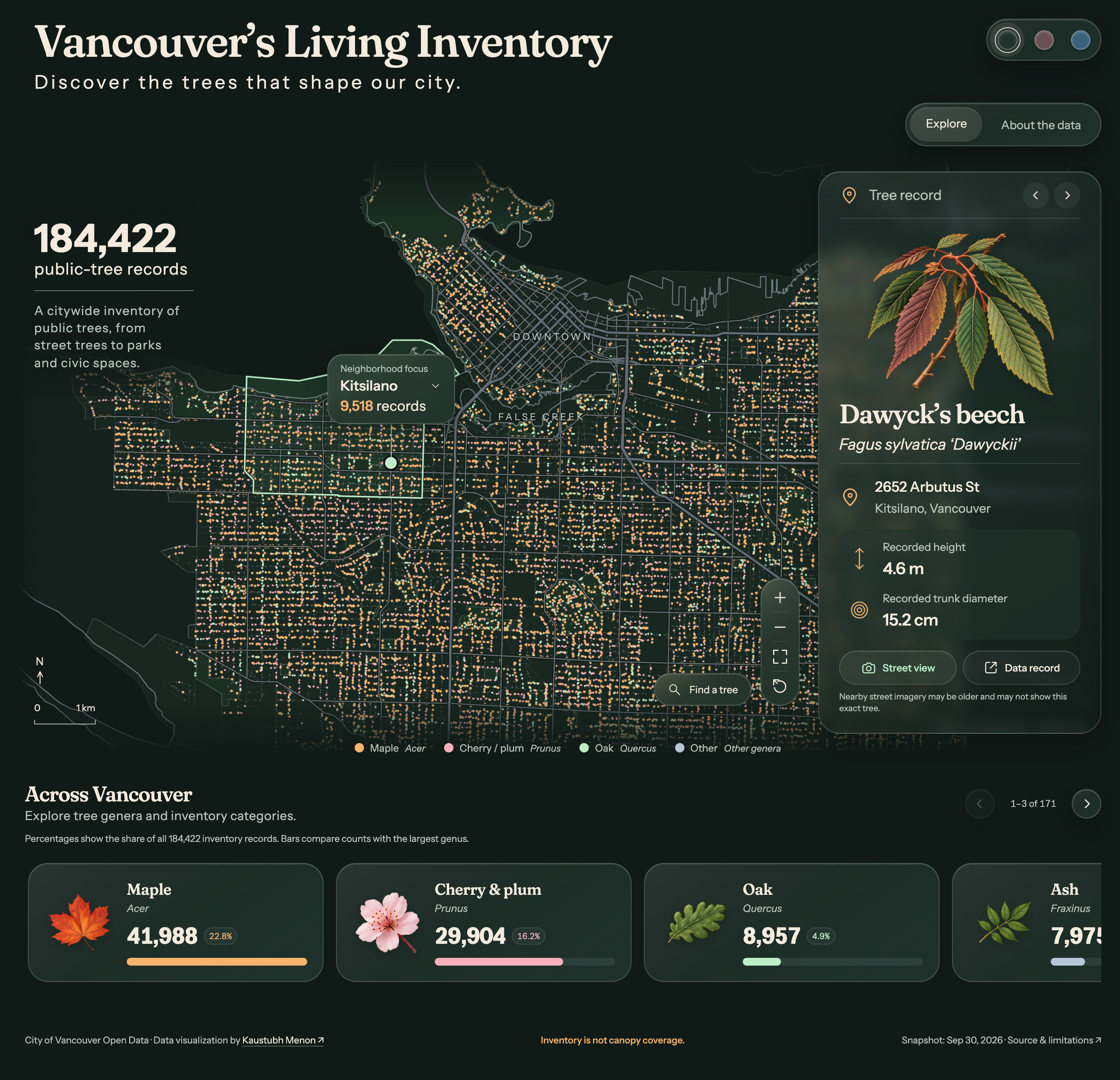
A citywide map connects public-tree locations, neighborhood context, selected records, and genus comparisons.
Decisions and system thinking
From citywide patterns to a single recorded tree
Geography, comparison, and record detail form connected entry points into the same public dataset.
Start with place.
Select map points, pan and zoom, or focus on a neighborhood. Genus filters and searchable tree records help move from a citywide view to a specific part of the inventory.
Make categories recognizable.
A carousel pairs 171 genus/category illustrations with inventory counts and proportions. The artwork represents genera rather than photographs of individual trees. Three dark palettes offer different visual treatments of the same data.
Keep context within reach.
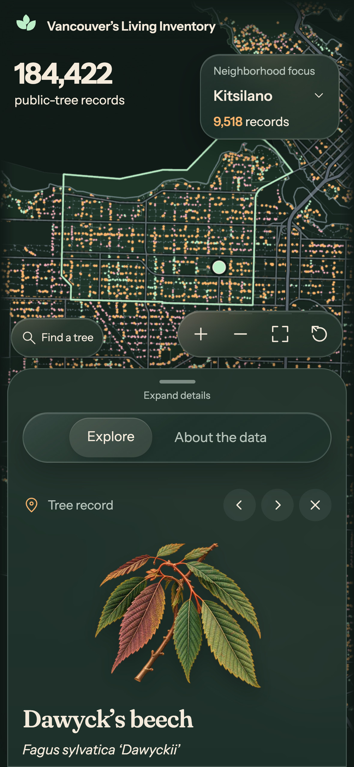
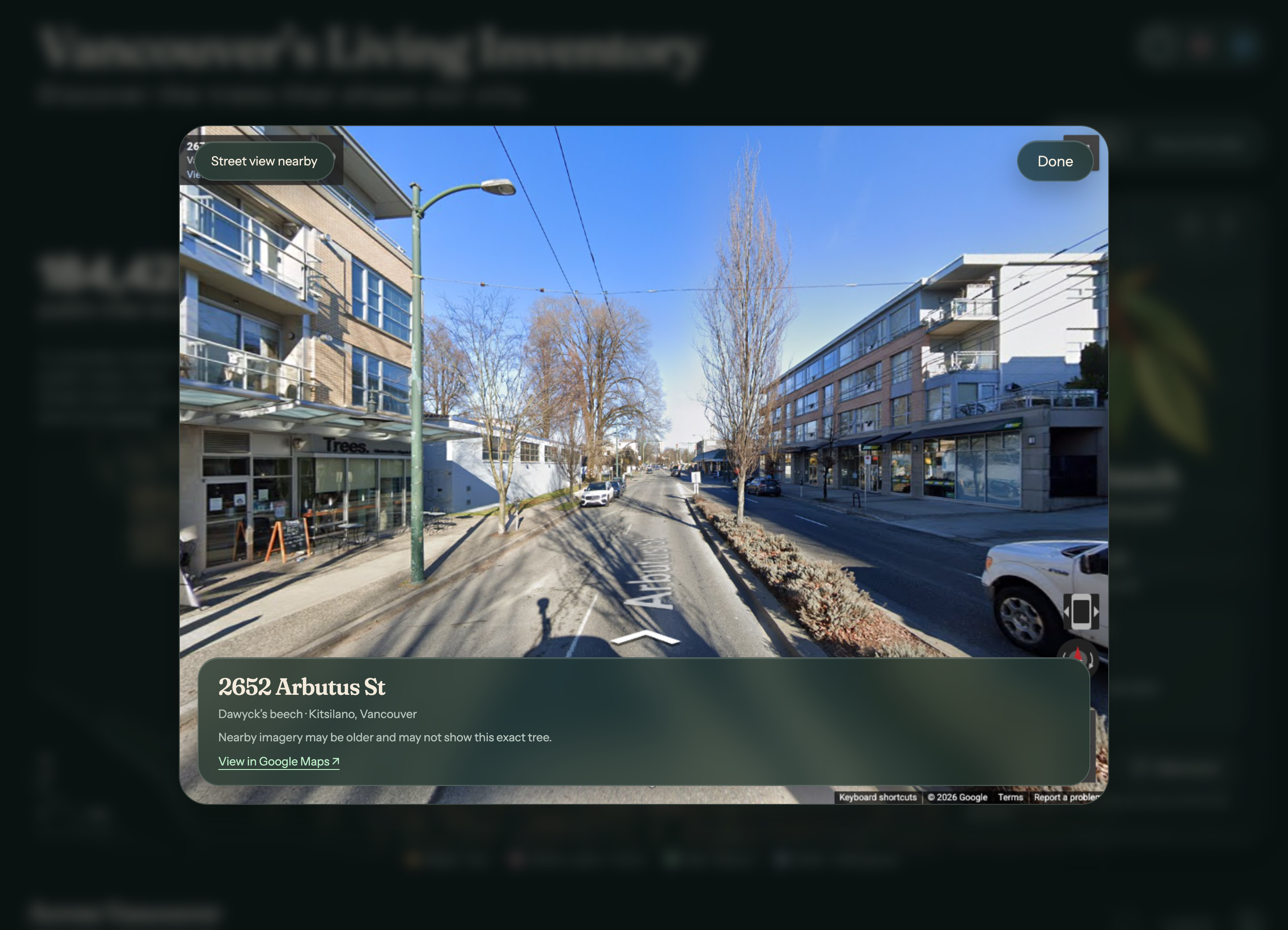
Selected records show location and recorded dimensions. Interactive Street View provides nearby street context, while a scrollable bottom drawer makes record details and the botanical index accessible on mobile.
Exploration workflow
Follow a question from map to record
- 01Explore the citywide inventory
- 02Focus by neighborhood or genus
- 03Select a map point or search for a record
- 04Inspect recorded attributes and nearby Street View
- 05Compare genera in the botanical index
Source and interpretation
An inventory of records, with clear limits
The City of Vancouver Open Data snapshot was retrieved on September 30, 2026. It contains 184,422 public-tree records, with 184,421 coordinates available to plot. Inventory is not canopy coverage and does not establish tree health, age, carbon storage, or private-tree totals. Recorded dimensions may be older than the snapshot. Illustrations represent genera; nearby Street View imagery does not verify an individual tree’s identity.
Design contribution
What I contributed across the product workflow
- Geographic and botanical information design
- Map selection, filters, and record search
- Genus/category illustration system
- Three dark visual palettes
- Responsive record cards and mobile bottom drawer
- Interactive nearby Street View integration
- Source attribution and data-limit communication
Explore public datasets through interactive visual experiences.